Reliable water level information is vital for understanding how flooding and inundation by tidal waters is affecting coastal wetlands. As the impacts of climate change continue to accumulate on tidal wetlands, the National Estuarine Research Reserve System is well positioned to combine high-precision, long-term sentinel site monitoring data into syntheses that document and evaluate these changes. These syntheses are helpful to plan targeted projects that can improve habitat resilience. Despite the rich body of tidal wetland work in the reserve system, long-term, wetland-specific water level monitoring data may not be available even for reserves that have well-developed sentinel site monitoring programs. In some cases, the nearest NOAA tidal station is located too far from a reserve’s wetlands to serve as an appropriate reference when assessing flooding in sentinel sites.
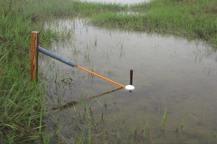
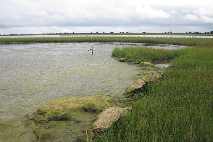
In this project, the team will employ a targeted training approach to bring Arm-and-Float water level loggers — special equipment designed and field-tested by the project lead — and expertise in hydrodynamic monitoring and tidal datum calculation to six reserves. Research staff from the partner reserves — the project end users — will guide site selection and assist with equipment deployment to their priority areas. The project team plans to produce a technical report describing how they deployed the new equipment at each site and what was learned, including how specific sites were chosen, how instruments were deployed, survey methods, tidal datum calculations, and a discussion of results generated. To raise awareness and advance the use of the new monitoring approach, they also plan to share the results with other reserves and the wider scientific community through presentations at conferences and meetings.
Project Lead Vitalii Sheremet (Okeanolog / Woods Hole Oceanographic Institution) gives an introduction to "Transfer of a Low-cost Tidal Wetland Water Level Monitoring System: Hyperlocal Calculations of Inundation and Tidal Datums for Understanding Change and Restoration Planning," a science transfer project funded in 2020 by the NERRS Science Collaborative. The presentation was given at a virtual project workshop in October 2021.