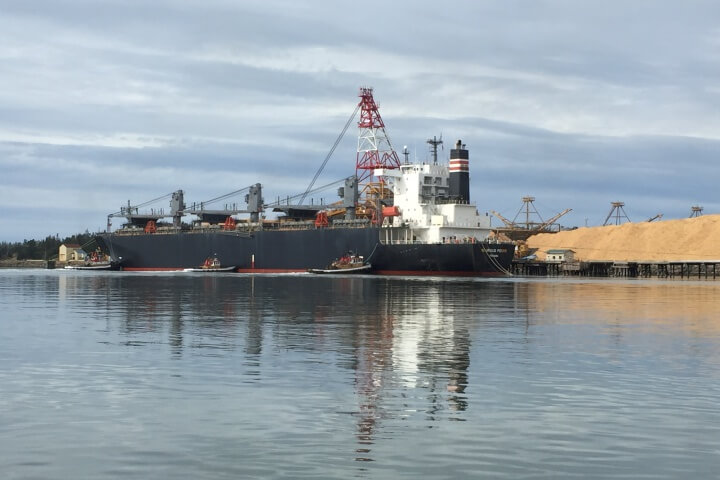
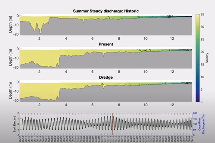
The Coos estuary has many diverse users who share a need for better information about water and sediment flows through the estuary under current and future conditions. Designated one of Oregon’s three “deep draft development” estuaries, planners must balance industry, restoration, and natural resource goals while addressing myriad management needs. This project filled data gaps, modeled circulation and sediment in the Coos Bay estuary, and showed how the estuary can be expected to respond to natural and human-caused disturbances such as dredging and sea level rise.
The project provided users with a dynamic picture of estuary conditions and habitat that has already begun to inform decision making. Its findings have direct application to the management needs of the South Slough National Estuarine Research Reserve and other estuary users such as Coos County, the Oregon Department of Fish and Wildlife, Oregon Department of Environmental Quality, and the Oregon Institute of Marine Biology. These end users were actively involved throughout the project, from identifying research objectives and products to applying research findings in support of estuary health. The project informed a broad range of management actions, such as updating the estuarine management plan, improving the success of oyster restoration projects, informing fisheries habitat maps, and increasing data efficiency among community stakeholders.