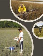
The 2018-2019 catalyst project Synthesizing Monitoring Data to Improve Coastal Wetland Management Across New England compiled salt marsh monitoring data from four New England National Estuarine Research Reserves (Great Bay, Narragansett Bay, Waquoit Bay, and Wells). These data were collected as part of the NERRs System Wide Monitoring Program to help manage local and regional salt marshes. The project used graphical and statistical analyses to assess regional trends in New England salt marsh vegetation, surface elevation, and flood duration.
About this resource
The project convened a series of three workshops with partners in the NERRS system, state and federal coastal managers, and nonprofit conservation and restoration groups. The first two workshops developed ideas and shared a research plan. The final workshop, held August 22 at Wells National Estuarine Research Reserve in Maine, shared project methods and initial results.
This draft presentation, given at the final project workshop, discusses key aspects of the project's process and its initial findings, including:
- Integration of different methods to measure plant abundance (point-intercept and ocular cover)
- Graphical, univariate, and multivariate statistical methods
- Salt marsh vegetation, surface elevation, and inundation changes over time across the region and at individual reserves
- Management implications
More detailed analysis is available in the project's data report.