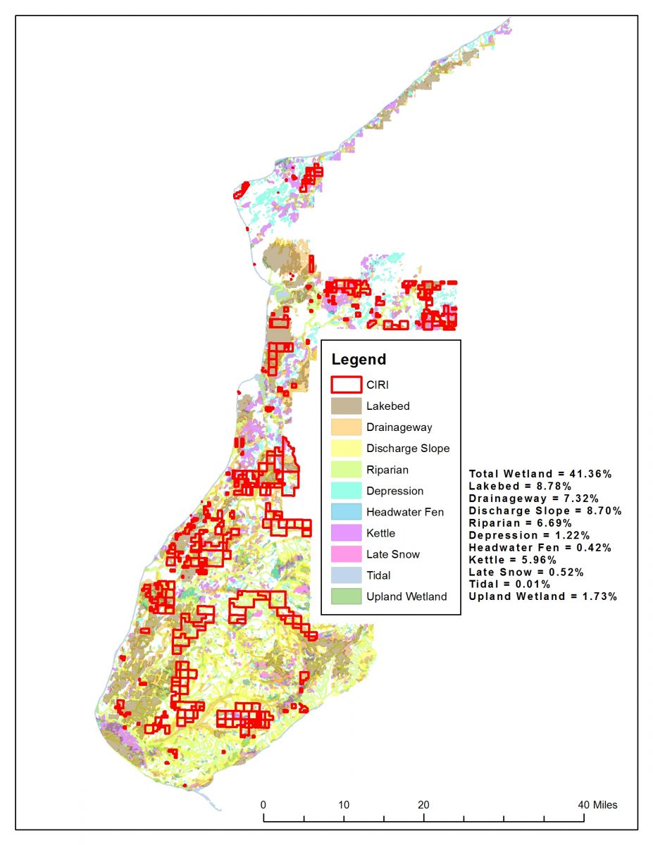
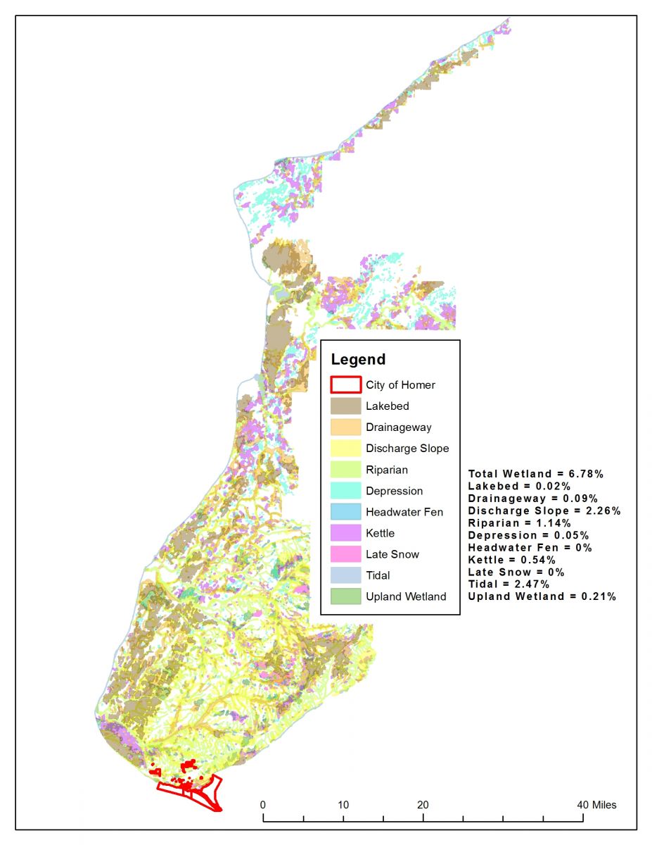
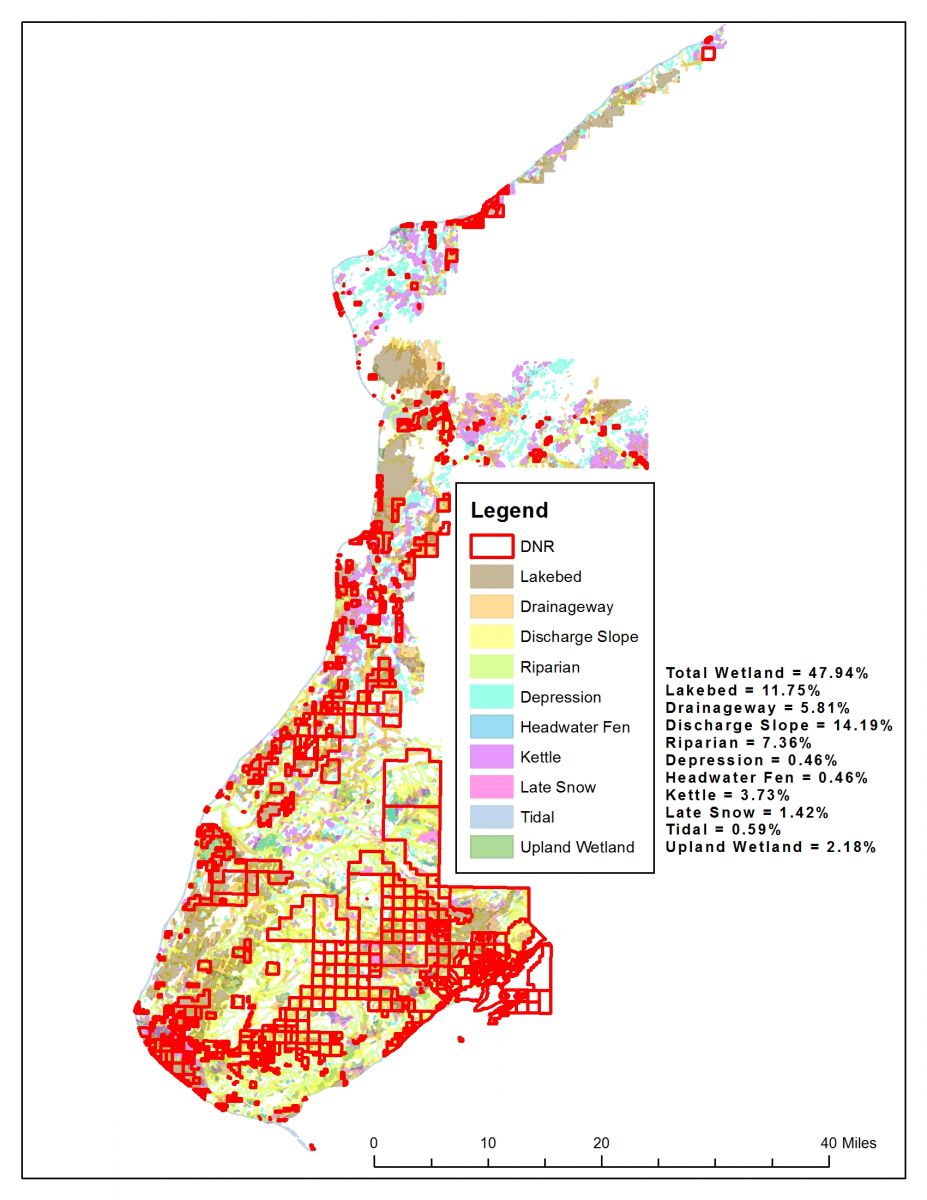
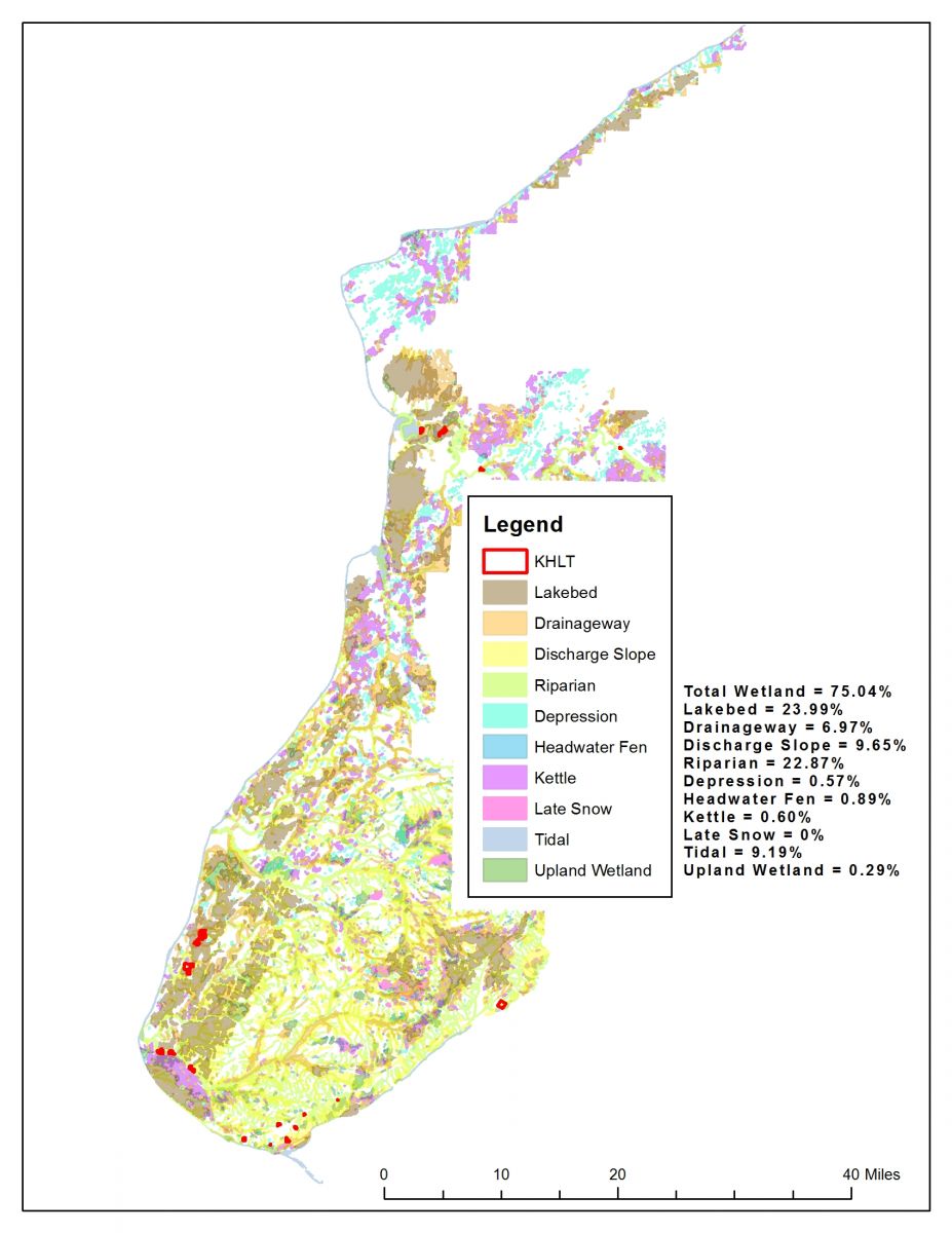
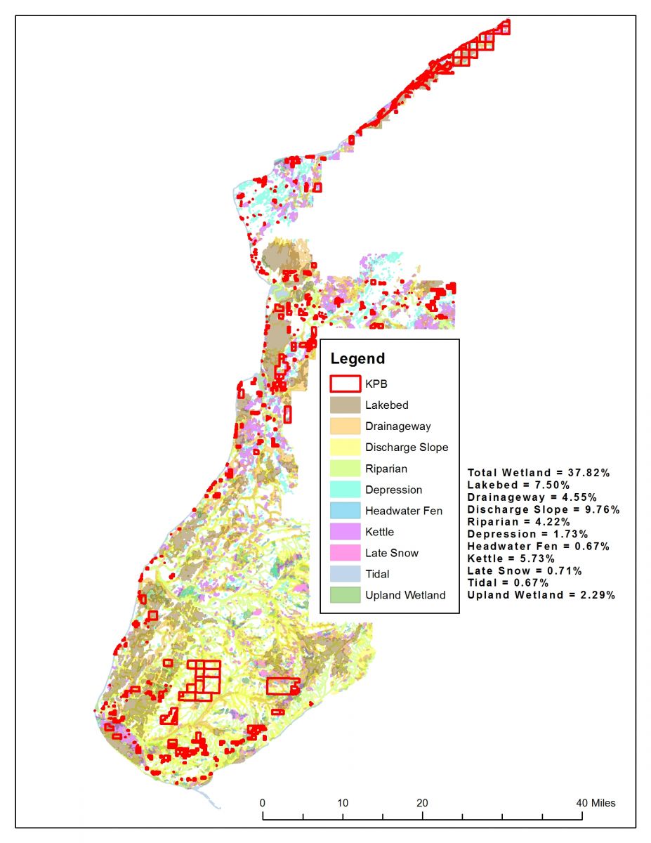
The Kenai Lowlands in southern Alaska cover 9,400 square kilometers and include huge expanses of wetlands, predominantly peatlands and tidal saltmarshes at river mouths and coastlines. As part of a project to assess the potential for blue carbon projects in this region, the Kachemak Bay National Estuarine Research Reserve and its partners created a series of GIS-generated maps showing wetland types by major land owners in the Kenai Lowlands region.
Cook Inlet Region Inc. wetland map
Enlarge/download mapTo download, right-click (or control-click) the image and choose “Save. ”
.
City of Homer wetland map
Enlarge/download mapTo download, right-click (or control-click) the image and choose “Save. ”
.