About this project
Surface Elevation Tables (SETs) are widely used to collect data on the dynamics of tidal wetland communities through precise measurements of marsh surface over time. Most sites within the network of 29 National Estuarine Research Reserves (NERRs) have been measuring SETs for several years, resulting in a need for tools to process, analyze, and communicate about surface elevation change.
A 2018 catalyst project developed a series of tools for working with SET data using R, RStudio, and associated packages, including a Quality Assurance/Quality Control (QA/QC) app and scripts to automatically generate reports about surface elevation change. These tools are being made available through GitHub and are intended to be used for future data entry, QA/QC, and analyses of SET data.
About this resource
Two project webinars are archived here to provide an introduction to the set of newly developed analysis tools Surface Elevation Table data.
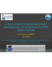
- Final Outreach webinar (2/13/2020) - This webinar video recording describes outreach tools developed for using SET data, including clearly annotated visualizations that can be used to communicate the results to both technical and non-technical audiences.
- Final Technical webinar (2/27/2020) - In this webinar, the team discussed the project goals and methods, presented national-level results of analyses of SET data, walked through a reserve-level report, and showed some of the interactive QA/QC app.
